Welcome to Aerial Drone Operators - Drone Property Survey
Our aerial drone services provide aerial photography, drone surveys, drone inspections, drone thermal imaging, drone security and drone surveillance
Our cutting-edge drone technology enables us to provide accurate and detailed property surveys that go beyond traditional methods. Whether you're a homeowner, real estate professional, or construction manager, our Drone Property Survey Service is designed to meet your specific needs.
At Aerial Drone UK able to work at a local level in the South West of England including Cornwall, Devon, Somerset and further afield in the rest of the UK from our base in Devon.
Why Choose Aerial Drone UK?
1. Precision and Accuracy
Our drones are equipped with state-of-the-art cameras and sensors, ensuring precise measurements and high-resolution imaging. This allows for a detailed analysis of your property, capturing even the smallest details with accuracy.
2. Time-Efficient
Traditional property surveys can be time-consuming. Aerial Drone UK streamlines the process by swiftly navigating your property and capturing data efficiently. This means faster turnaround times for survey results, enabling you to make informed decisions promptly.
3. Cost-Effective
Our Drone Property Survey Service is not only efficient but also cost-effective. By utilising advanced technology, we eliminate the need for expensive equipment and extensive on-site labor, providing you with a budget-friendly solution without compromising on quality.
4. Comprehensive Insights
Gain comprehensive insights into your property with our detailed survey reports. From topographical mapping to 3D modelling, we cover a wide range of survey types, providing you with the information you need for various purposes, such as construction planning, property development, or insurance assessments.
Services Offered
1. Topographical Mapping
Our drone surveys generate accurate topographical maps, offering valuable information about the elevation, slopes, and natural features of your property.
2. 3D Modeling
Visualise your property in three dimensions with our advanced 3D modelling services. This is especially useful for architects, developers, and urban planners.
3. Construction Site Monitoring
Keep track of construction progress with regular drone surveys, ensuring projects stay on schedule and within budget.
4. Roof Inspections
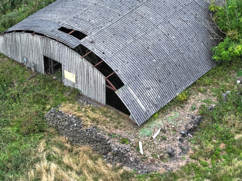
Identify potential issues with your roof without the need for expensive and risky manual inspections. Our drones capture detailed images, helping you address problems early on.
5. Estate Agent Marketing
Enhance your property listings with stunning aerial views. Showcase the unique features of your property and attract potential buyers with captivating visuals.

