Welcome to Aerial Drone Operators - Drone Topographic Surveys
Our Aerial Drone topographic survey services provide highly accurate survey grade data, improving you project precision, cost efficiency and safety
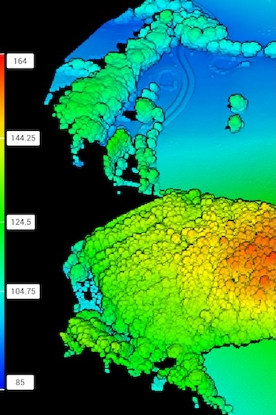
At Aerial Drone UK our topographic survey service use the latest drone LiDAR and photogrammetry technology to gather georeferenced data with survey grade accuracy, in a safe, cost effective and timely manner. We build topographical maps and models for you to make informed decisions for your project.
Aerial Drone UK are able to work on your drone topographic survey at a local level in the South West of England including Cornwall, Devon, Dorset, Somerset and further afield in the rest of the UK from our base in Devon.
Why Choose Aerial Drone UK for Topographic Surveys?
-
Precision and Accuracy
Our advanced drones carry the latest LiDAR and photogrammetry technology, with high resolution centimetre accurate survey grade precision. Creating you an accurate and detailed topographic map or model of your survey area.
-
Cost Effective
Drone topographic surveys allow for rapid data collection, are more consistent for frequent surveys and more economical then traditional survey methods.
-
Enhanced Safety
Drones can access safely inaccessible and hazardous areas, reducing the risk of accidents and ensuring the safety of those around.
-
Flexible Deployment
Our drone LiDAR equipment enables us to deploy in adverse conditions such as low light, night, rain and fog. Allowing for timely, cost effective topographic data collection.
-
Environmental Sustainability
Our topographic drone surveys help to minimise the carbon footprint of a project, helping companies achieve their net-zero targets.
Applications of Drone Topographic Surveys:
1. Construction and Development
Accurate 3D Models and georeferenced 2D maps aid in construction planning, construction monitoring progress, and identifying potential issues before they escalate.
2. Land Management
Precise 3D Models and 2D Maps for example, digital elevation models (DEM), digital surface models (DSM) and digital terrain models (DTM) are used to ensure efficient utilisation of land, for example forestry, water management, soil erosion, ecology and bio-diversity.
3. Environmental Monitoring
Drones assist in monitoring and assessing environmental changes, such as deforestation, erosion and wildlife habitats. This information is crucial for land management and conservation.
4. Infrastructure Inspection
3D modeling provides precise representation which can be used for planned preventable maintenance (PPM) and inspection work. Ideal for critical infrastructure, such as bridges, power lines, pipelines and commercial building inspections.

